Additional Information
Book Details
Abstract
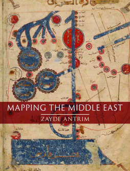
Mapping the Middle East explores the many ways people have visualized the vast area lying between the Atlantic Ocean and the Oxus and Indus River Valleys over the past millennium. By analyzing maps produced from the eleventh century on, Zayde Antrim emphasizes the deep roots of mapping in a region too often considered unexamined and unchanging before the modern period. As Antrim argues, better-known maps from the nineteenth and twentieth centuries—a period coinciding with European colonialism and the rise of the nation-state—not only obscure this rich past, but also constrain visions for the region’s future.
Organized chronologically, Mapping the Middle East addresses the medieval “Realm of Islam;” the sixteenth- to eighteenth-century Ottoman Empire; French and British colonialism through World War I; nationalism in modern Turkey, Iran, and Israel/Palestine; and alternative geographies in the twentieth and twenty-first centuries. Vivid color illustrations throughout allow readers to compare the maps themselves with Antrim’s analysis. Much more than a conventional history of cartography, Mapping the Middle East is an incisive critique of the changing relationship between maps and belonging in a dynamic world region over the past thousand years.
“In Middle Eastern studies, the history of cartography is a relatively underdeveloped field, certainly in comparison to other areas of the world. This excellent book on the history of mapping of the Middle East is a game-changer. It offers a sensible, accessible, and nuanced contextual analysis of maps of the Middle East since the early Islamic period to this day, including maps that appear in diverse media, not only the stand-alone map but also stamps, donation boxes, and art. To the best of my knowledge, no other book on the history of mapping in the region offers such an informative and informed introduction. Moreover, the author dares to cover both the premodern and modern traditions of mapping, a comparative intervention that enriches our understanding of every aspect of these maps. . . . This beautifully produced book should be of interest to a wide readership.”
— Bulletin of SOAS
“In this analysis of a millennium of cartography of the ever-changing region, Antrim provides welcome insights into the evolving function and meaning of its maps. This detailed and lavishly illustrated volume spans the ‘realm of Islam’ (eleventh to sixteenth centuries), where maps served more as memory aids than accurate geographical representation. . . . Academic yet highly readable, this book presents the history behind the maps.”
— AramcoWorld
“Antrim deserves credit for tackling a difficult subject that the current political system seems unable to resolve. . . . This is an exciting book that clearly belongs in any bibliography of the Middle East, in any course syllabus on the history of cartography, and on the bookshelf of anyone interested in the lasting consequences of exploration, discovery, and nation-building.”
— Terrae Incognitae
Zayde Antrim is associate professor of history and international studies at Trinity College in Hartford, CT. She is the author of Routes and Realms: The Power of Place in the Early Islamic World.
Table of Contents
| Section Title | Page | Action | Price |
|---|---|---|---|
| Cover | Cover | ||
| Title Page | 3 | ||
| Imprint Page | 4 | ||
| Contents | 5 | ||
| Note on Spelling, Dates and Sources | 7 | ||
| Introduction: On the ‘Middle East’ and Mapping | 9 | ||
| One: Mapping the ‘Realm of Islam’ | 17 | ||
| Two: Mapping in the Ottoman Empire | 63 | ||
| Three: European Colonial Mapping in the Long Nineteenth Century | 111 | ||
| Four: Enclosure and Exclusion in National Mapping | 175 | ||
| Five: Mapping Alternative Geographies | 235 | ||
| References | 265 | ||
| Bibliography | 303 | ||
| Acknowledgements | 323 | ||
| Photo Acknowledgements | 325 | ||
| Index | 327 |
